Introduction
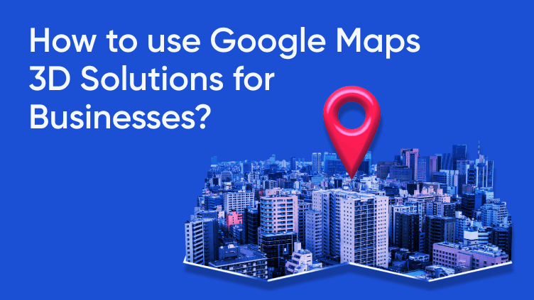
In the digital age, the way we interact with maps has evolved significantly, with Google Maps leading this transformation. Google Maps is not just for getting from point A to B; it has morphed into a robust platform that offers detailed geographic insights through its 3D Solutions. These advanced mapping technologies offer businesses an array of opportunities to enhance their operations and customer interactions. This blog post delves into the capabilities of Google Maps 3D Solutions, illustrating their benefits and providing a guide on how businesses can effectively integrate this technology into their strategies.
Understanding Google Maps 3D Solutions
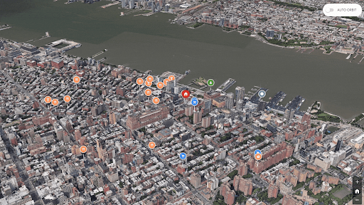
Google Maps 3D Solutions transform the traditional flat maps into vibrant, three-dimensional visuals of landscapes and cityscapes. This technology uses photogrammetry to stitch together images from various angles, creating detailed 3D representations of buildings, terrain, and urban infrastructure. The result is a more immersive and interactive experience that can be pivotal for businesses needing detailed geographic insights.
Key Features:
3D Visualization: Allows users to explore an area in three dimensions, offering a realistic view of buildings, terrain, and landmarks.
Street View Integration: Combines 3D models with street-level imagery, enabling detailed visual assessments of locations.
Custom Overlays: Businesses can overlay custom data on the 3D map, such as service areas, delivery routes, or property boundaries.
Benefits of Google Maps 3D Solutions for Businesses
Enhanced Customer Experience
By integrating Google Maps 3D into their websites or apps, businesses can provide customers with interactive and detailed views of venues, real estate properties, or tourist attractions, leading to increased engagement and satisfaction.
Improved Operational Efficiency
Logistics and delivery companies can use 3D maps to plan more efficient routes, taking into account terrain and building layouts. This can reduce travel time and costs associated with deliveries.
Better Decision-Making
Real estate and construction firms can use 3D views to assess property layouts and surrounding areas, helping stakeholders make informed decisions without needing on-site visits.
Applications in Different Industries
- Real Estate and Property Development
– Visualize property layouts in 3D, providing potential buyers with a realistic view of properties and their surroundings.
– Enhance online property listings with interactive 3D tours, increasing engagement and interest among prospective clients.
- Retail and Hospitality
– Optimize store locations by analyzing the 3D map to understand foot traffic, nearby businesses, and the overall layout of an area.
– Improve customer experience by integrating 3D maps on websites for easy navigation to hotels, restaurants, or retail stores.
- Logistics and Transportation
– Plan more efficient routes by considering topographic features and urban layouts in 3D, reducing fuel consumption and delivery times.
– Use 3D maps for warehouse management to visualize and organize space more effectively.
- Tourism and City Planning
– Enhance tourist experiences by offering 3D virtual tours of attractions, historical sites, and urban areas.
– Assist in urban planning and development with a better assessment of existing infrastructure and potential growth areas.
How Businesses Can Implement Google Maps 3D Solutions
Step 1: Accessing the API
Businesses need to access the Google Maps API by signing up for an API key through the Google Cloud Platform. This key allows them to integrate maps into their applications.
Step 2: Customizing Maps
Utilize the API to customize the 3D map according to business needs. This includes setting the location, adjusting the zoom level, and adding custom overlays like logos or operational areas.
Step 3: Integrating into Platforms
Embed the customized map into your business platforms, such as websites or mobile apps. Ensure that the integration is seamless and enhances the overall user interface.
Step 4: Analyzing Data
Leverage analytics to understand how users interact with the map. This data can help further refine map features and improve user engagement.
Conclusion
Google Maps 3D Solutions is a revolutionary tool for businesses across various industries. By transforming conventional maps into interactive, three-dimensional landscapes, it empowers businesses with enhanced visual data that improves decision-making, operational efficiency, and customer satisfaction.Whether it’s for improving customer interaction, making informed strategic decisions, or optimizing operational processes, 3D mapping is an invaluable asset in the digital toolkit of modern businesses.